Dataset | Publication to Cite | Image | Links |
INDOFLOODS: A Comprehensive Database for Flood Events in India Enhanced with Catchment Attributes | 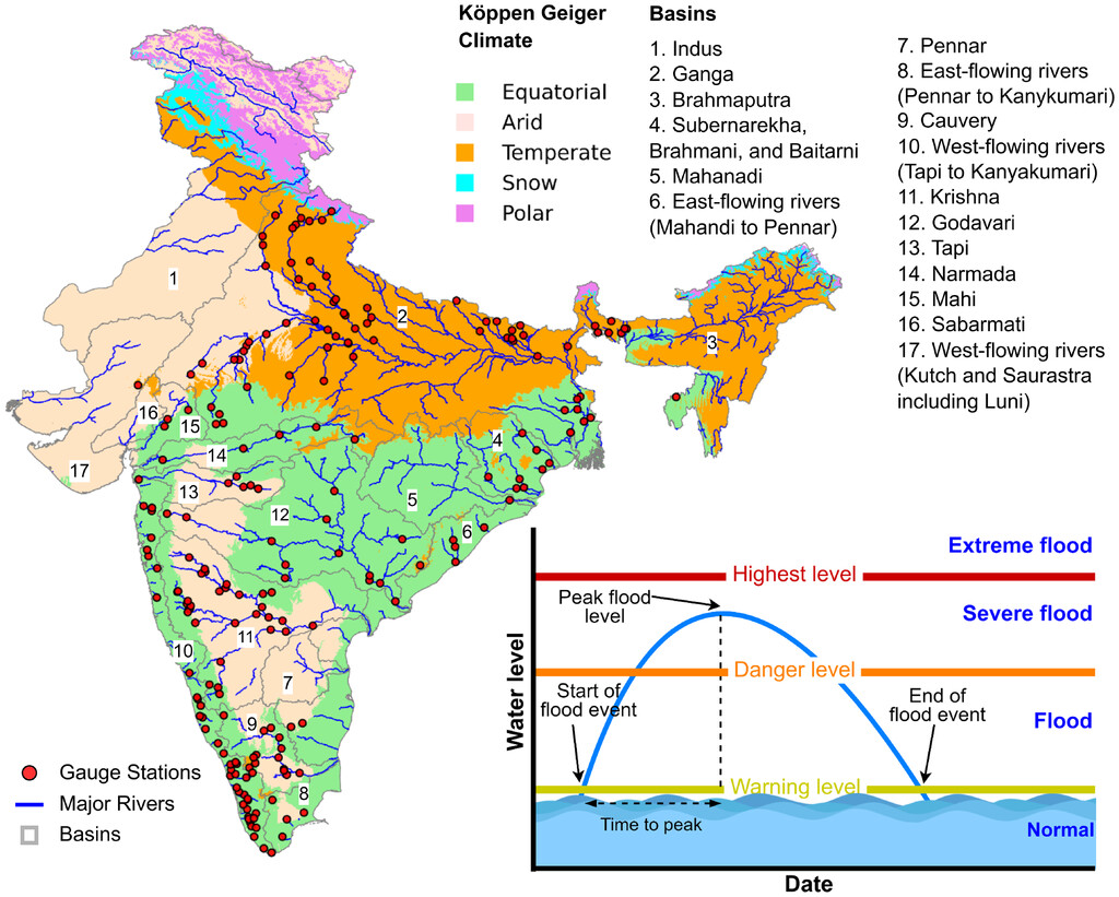 | ||
Indian Precipitation Ensemble Dataset (IPED): A station-based 0.1-degree daily gridded ensemble precipitation dataset for India | 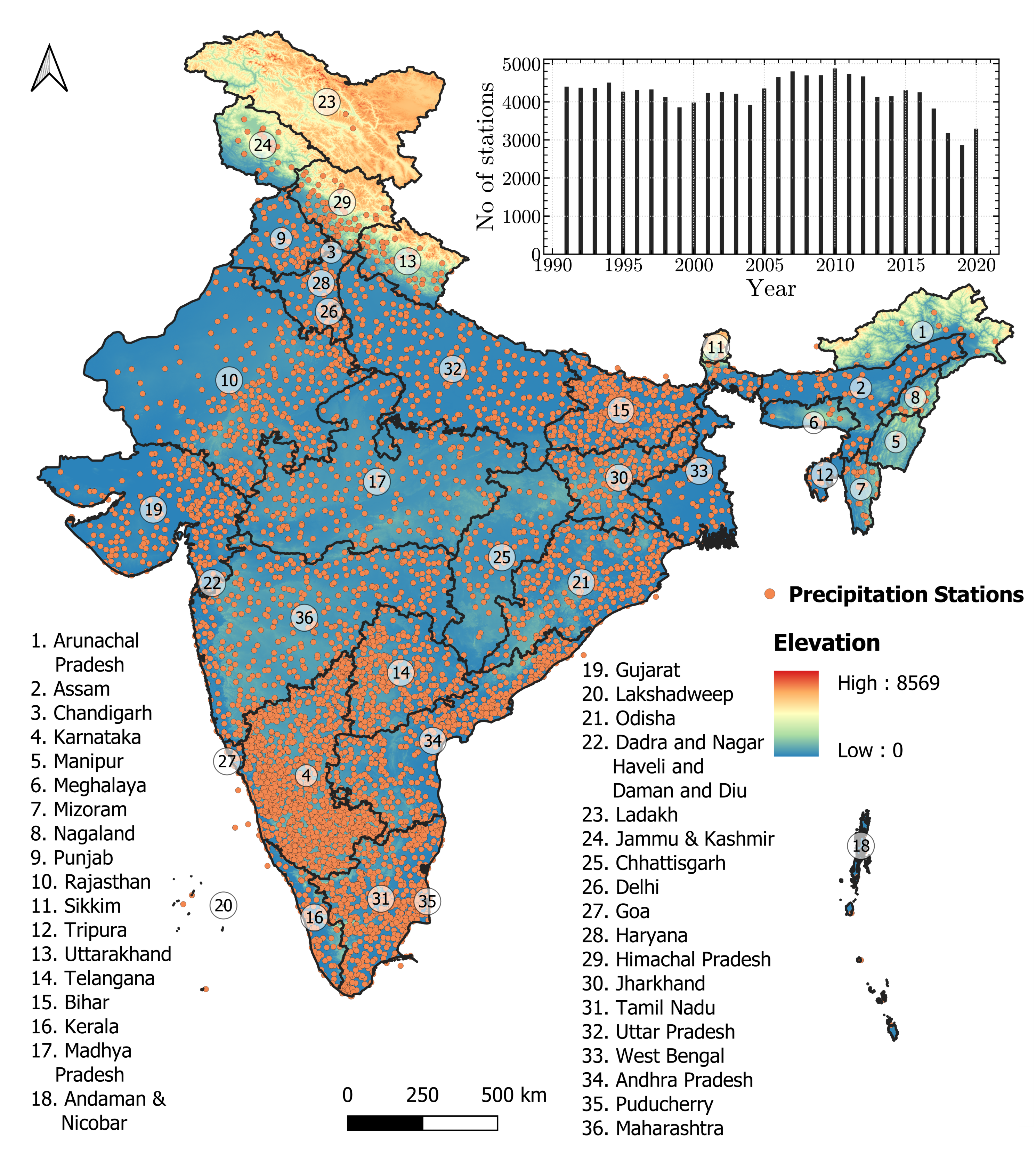 | ||
Indian Landslide Susceptibility Map (ILSM), 100m | |||
Global Flood characterization (GloFlo): Globally representative dataset of streamflow extremes, geomorphology, meteorology, climatology, landcover, lithology, etc. | 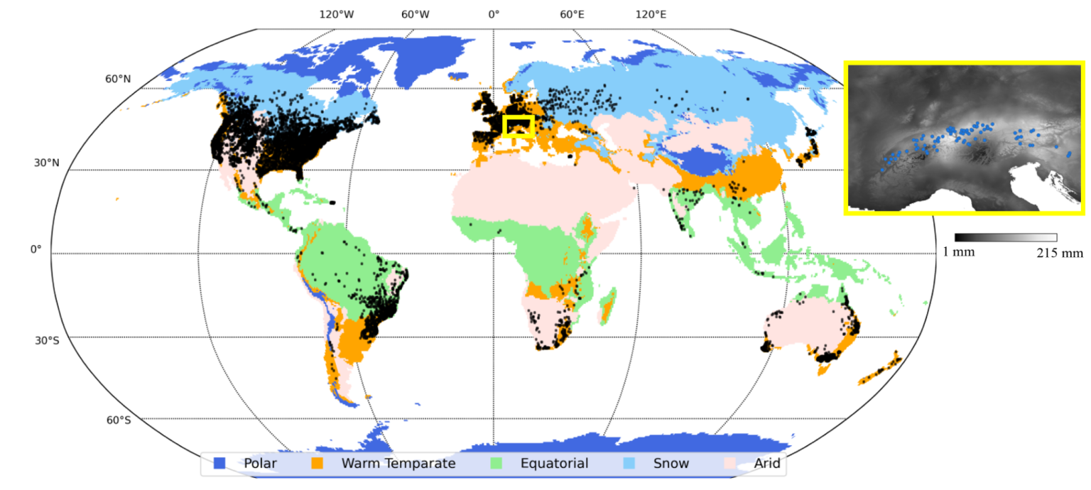 | ||
India Flood Inventory: The first freely available, analysis-ready geospatial dataset of floods over India. Developed in collaboration with Indian Meteorological Department (IMD). | 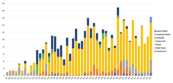 | ||
Indian Rainfall Erosivity Dataset (IRED): National-scale assessment of rainfall erosivity over India using gridded precipitation datasets. | 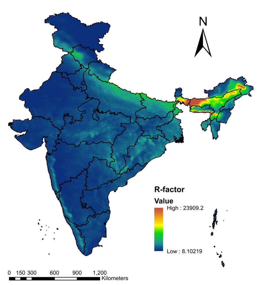 | ||
Indian Soil Erodibility Dataset (ISED): The first national-scale assessment of soil erodibility over India at 250m spatial resolution. | 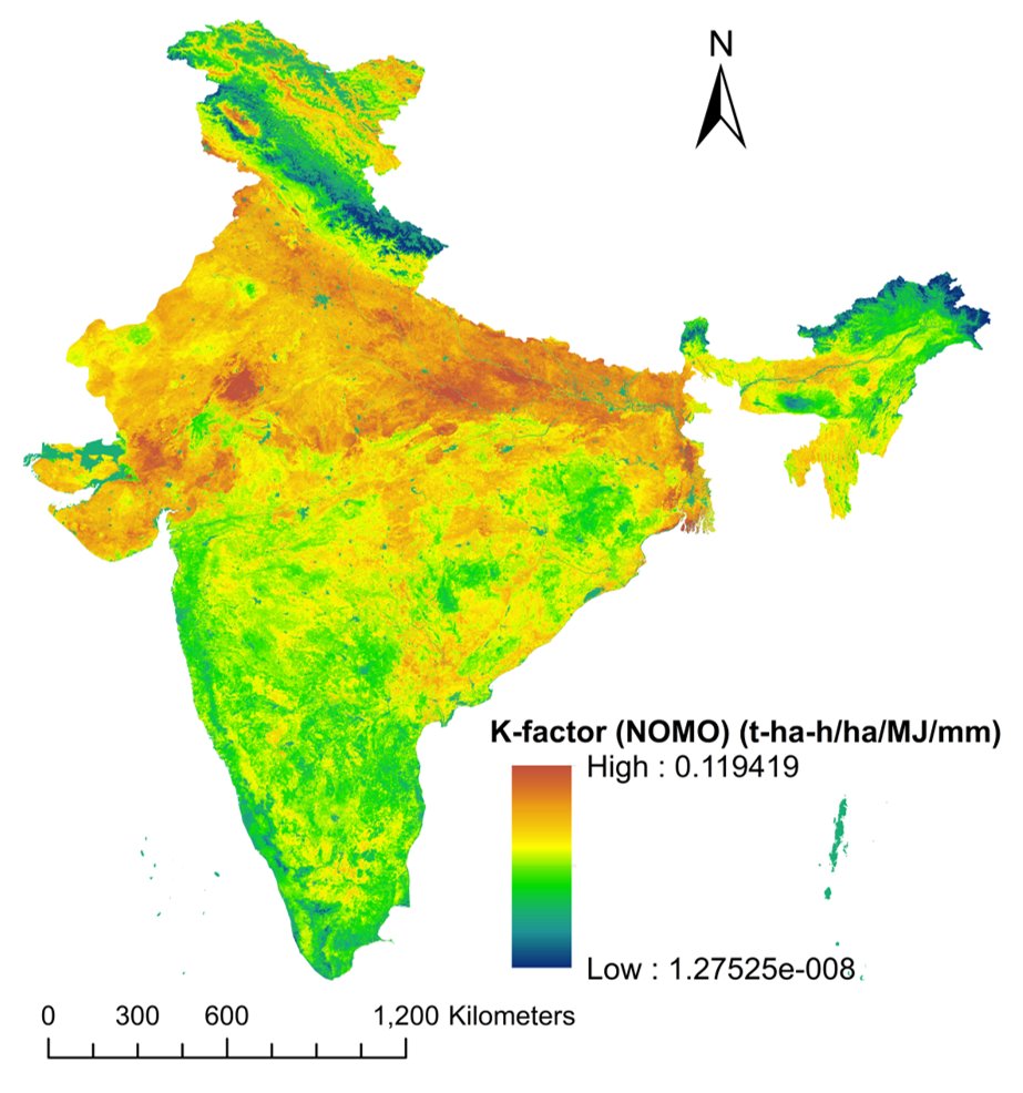 | ||
Indian Water Erosion Dataset (IWED): Annual Potential Soil Loss (PSL), Sediment Delivery Ratio (SDR), Specific Sediment Yield (SSY) and all the five factors (R, K, LS, C and P) of the RUSLE Model at the national scale. | 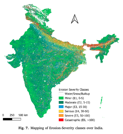 | ||
United States Flash Flood Severity (Flashiness): A new concept of “Flashiness” for measuring flash flood severity was proposed and predicted across the United States. | 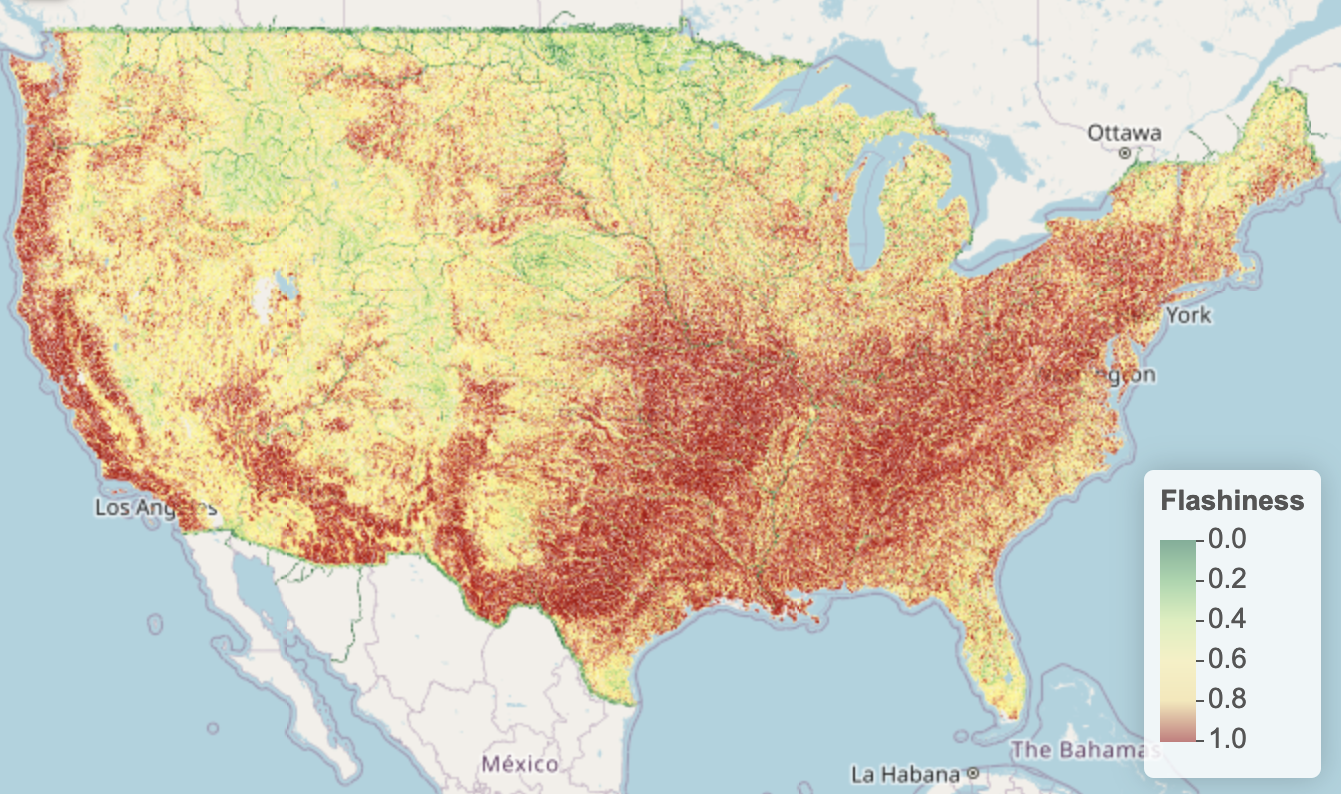 |